 AlbertaSell
Airdrie Meadows
Includes Acacia Drive SE and Alpine Crescent SE on the municipal map.
Calgary region · Seller guidance
Airdrie’s neighbourhood map distinguishes urban and rural areas. Start with your civic address, then compare the type of property you own. A finished home, a serviced lot and an industrial bay each call for a different pricing review.
Browse area guides ↓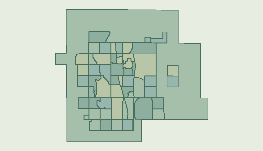
Includes Acacia Drive SE and Alpine Crescent SE on the municipal map.
Includes 567 Highway and Range Road 291 N/A on the municipal map.
Includes Bayside Drive SW and Bayside Boulevard SW on the municipal map.
Includes Baysprings Gdns SW and Bayview Street SW on the municipal map.
Includes Bayview Crescent SW and Bayview Way SW on the municipal map.
Includes Big Springs Drive SE and Big Hill Circle SE on the municipal map.
Includes Buffalo Rub Place NW on the municipal map.
Includes Canals Crssng SW and Canals Circle SW on the municipal map.
Includes Chinook Gate Boulevard SW and Chinook Gate Drive SW on the municipal map.
Includes Cobblestone Boulevard SW and Cobblestone Gate SW on the municipal map.
Includes Coopers Drive SW and Coopers Crescent SW on the municipal map.
Includes Croxford Estate NE on the municipal map.
Includes 1 Avenue NW and Mackenzie Way SW on the municipal map.
Includes Dry Creek Bay SW on the municipal map.
Includes East Lake Road NE and East Lake Boulevard NE on the municipal map.
Includes Erin Drive SE and Main Street S on the municipal map.
Includes Edmonton Trail SE and Edmonton Trail NE on the municipal map.
Includes Fairways Drive NW and Fairways Circle NW on the municipal map.
Includes Gateway Drive NE and Gateway Road NE on the municipal map.
Includes Hamilton Green NE on the municipal map.
Includes Veterans Boulevard NE and Highland Park Boulevard NE on the municipal map.
Includes Hillcrest Drive SW and Hillcrest Road SW on the municipal map.
Includes Edmonton Trail NE and Flett Drive NE on the municipal map.
Includes Key Drive SW and Key Cove SW on the municipal map.
Includes Kingsview Boulevard SE and Kings Heights Drive SE on the municipal map.
Includes Lanark Boulevard SE and Lancaster Hts SE on the municipal map.
Includes Luxstone Boulevard SW and Luxstone Landng SW on the municipal map.
Includes Meadow Brook Drive SE and Marquis Place SE on the municipal map.
Includes Midtown Avenue SW and Midtown Drive SW on the municipal map.
Includes Coopers Drive SW and Morningside Gdns SW on the municipal map.
Includes 1 Street NW and 5 Avenue NW on the municipal map.
Includes Chinook Winds Drive SW and Prairie Springs Crescent SW on the municipal map.
Includes Ravenswood View SE and Ravenswood Drive SE on the municipal map.
Includes Veterans Boulevard NW and Reunion Green NW on the municipal map.
Includes Ridgebrook Drive SW and Rideau Close SW on the municipal map.
Includes Sagewood Boulevard SW and Sagewood Drive SW on the municipal map.
Includes Sawgrass Gate NW and Sawgrass Street NW on the municipal map.
Includes Main Street S and Sierra Springs Drive SE on the municipal map.
Includes Silver Springs Way NW and Creek Gardens Close NW on the municipal map.
Includes Main Street S and South Point Gate SW on the municipal map.
Includes Windsong Boulevard SW and Osborne Drive SW on the municipal map.
Includes 40 Avenue SW and Southwinds Drive SW on the municipal map.
Residential / local property owner guidance for this mapped area.
Includes Stonegate Drive NW and Stonegate Way NW on the municipal map.
Includes Main Street S and Summerfield Boulevard SE on the municipal map.
Includes Sun Ridge Crescent NW and Sun Ridge Place NW on the municipal map.
Includes Centre Avenue E and 1 Avenue NE on the municipal map.
Includes Thorburn Drive SE and Tanner Drive SE on the municipal map.
Includes Vantage Crescent SW and Vantage Drive SW on the municipal map.
Includes Waterstone Crescent SE and Waterstone Place SE on the municipal map.
Includes Baneberry Way SW and Fowler Road SW on the municipal map.
Includes Williamstown Boulevard NW and Veterans Boulevard NW on the municipal map.
Includes Willow Brook Drive NW and Willow Brook Close NW on the municipal map.
Includes Windridge Road SW and Windhaven Close SW on the municipal map.
Includes Woodside Drive NW and Woodside Crescent NW on the municipal map.
Includes Pinto Lane SE and Mustang Lane SE on the municipal map.
Provide the civic address and legal description. Confirm whether the parcel carries residential, business or rural use and which services are in place before selecting comparisons.
Request a home valuationDiscuss a commercial saleOffer space for leaseDiscuss a land parcel